From the Field: Bikol, the Philippines
The following report was provided by Robin Meyer-Lorey, UCLA graduate student in Anthropology, who spent the summer of 2022 in the Philippines working on his MA capstone project.
Figure captions:
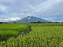
Figure 1. Mount Isarog, an iconic landmark in Bikol, the Philippines. This is the view while surveying for sites in a rice field system. The Bikol region was home to extensive mechanized logging by American corporations during the American colonial regime in the Philippines. Two key sites were identified in Tamban and Tandoc, Siruma.
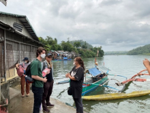
Figure 2. My conversation with Barangay Captain Annie Cabral. Community-engaged work allowed me to interview community leaders and local residents about American Industry in Siruma with the help of incoming Cotsen Institute PhD student Earl John Hernandez. (A barangay is a small territorial and administrative district forming the most local level of government in the Philippines.) To my left is Prof. Stephen Acabado, chair of the Archaeology program at the Cotsen Institute and director of the UCLA Center for Southeast Asian Studies. In the background is Maddie Yakal, UCLA graduate student in Anthropology who was co-director of this year’s field season. Many older community members could recall the presence of the logging company in their childhoods and also recounted stories told by parents and grandparents. Collaboration with the Archdiocese of Caceres made this research possible because of the important role of priests in the region. Detailed drone maps of barangays, three-dimensional models of buildings, and aerial photography were all important products that we provided to community members and local governments.
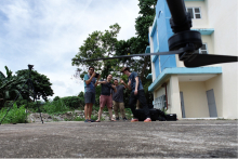
Figure 3. Drone selfie taken by incoming Cotsen Institute PhD student Earl John Hernandez after a successful test flight. Eager field school students learned archaeological remote sensing techniques by operating our drone and LiDAR equipment during practice flights and survey missions.
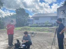
Figure 4. Cotsen Institute PhD student Yen Chun Wang (left) and incoming Cotsen Institute PhD student Earl John Hernandez (right) assist in setting up for a LiDAR mission. This project will be one of the first archaeological LiDAR studies from a drone in Southeast Asia. A generous grant from the Philippine Commission on Higher Education allowed Partido State University Goa to purchase this Matrice 300 RTK drone system and Zenmuse L1 LiDAR sensor, which are instrumental in the design of my MA research. Practical field experience with this equipment enabled me to hone expertise and self-teach new skills that can assist in many future research projects with students from the Cotsen Institute and the Anthropology Department at UCLA.
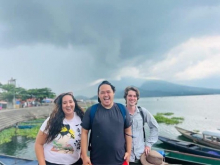
Figure 5. Cotsen Institute PhD students Edward Cleofe (center), Iman Nagy (left), and the author at Lake Buhi enjoying some R&R after a mapping mission for community collaborators.
Published on July 25, 2022.
