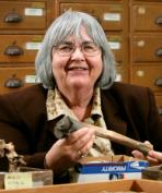
Elizabeth F. Carter

Professor Emerita, Department of Near Eastern Languages and Cultures (NELC)
Education
Ph.D., University of Chicago, 1971
Areas of Interest
Near East, currently working in Turkey and southeastern Turkey; Bronze Age urban sites
Research
The Kahramanmaras archaeological project aims to produce a record of long-term cultural changes in a region at a major crossroads between highlands and lowlands along the Syro-Anatolian frontier. Until the National Geographic Society sponsored our surveys in 1993-1994, no serious archaeological work had been done in the Kahramanmaras region of south central Turkey since 1887. A major goal of our archaeological surveys is to create a series of maps that will place the archaeological sites in their environmental settings through time. To date two hundred and twenty-seven archaeological sites have been located on a detailed 1/25,000 map. The area covered by our extensive survey was approximately 1100 square kilometers. We have discovered, recorded, and mapped manufacturing sites (flint tools, ceramics); several quarrying facilites; extensive cemetery sites, hilltop forts, and small farmsteads. The earliest site identified (KM43) dates to the Paleolithic (ca. 250,000 BC); the latest sites are of Medieval date (11–13th centuries AD). Early in the Iron Age, Kahramanmaras was the center of an independent kingdom called Gurgum.
ADDITIONAL LINKS
A Day in the Life of the Domuztepe Excavations
Domuztepe 2002 Field Season
The Incirli Stela
Turkish Newspaper Article


